webshop.nl
Categorieën
  Sluiten

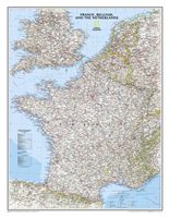
Wandkaart Frankrijk, België en Nederland, 60 x 77 cm | National Geographic

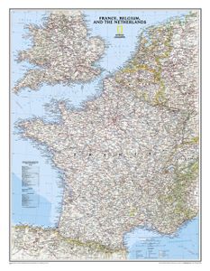
>Our classic wall map of France, Belgium, and the Netherlands shows political boundaries, major highways and roads, cities and towns, and a wealth of other incredibly accurate geographic detail.    France the map shows the division of the country into regions, with a list of their names and regional capitals (curiously, Corsica is not included on t...
25,95

Webshops met dit product

Webshop
Bezorging
Prijs

Anderen bekeken ook

Wandkaart Frankrijk, België en Nederland, 60 x 77 cm | National Geographic
Our classic wall map of France, Belgium, and the Netherlands shows political boundaries, major highways and roads, cities and towns, and a wealth of other incredibly accurate geographic detail.  n France the map shows the division of the country into regions, with a list of their names and regional capitals (curiously, Corsica is not included on the map – what would Napoleon think of that?). The map also provides plenty of names of both geographical features (Pyrenees, Cevennes, etc) and the country’s traditional historical regions (Gascony, Maine, Bourbonais, etc). National parks are highlighted.   Within Belgium the map indicates the division into Flanders, Wallonia and the Brussels Region and in the Netherlands boundaries of the country’s administrative provinces are marked.   Topography is shown by relief shading and within the Netherlands the areas below the sea level are also indicated. The map shows the network of main road and rail connections, local airports, as well as ferry …
31,95
Wereldkaart Natuurkundig, oceaanbodem, 116 x 77 cm | National Geographic
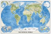
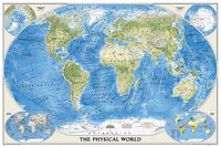
Bijzonder fraaie natuurkundige kaart van National Geographic waarbij het accent ligt op de fysische aspecten van de aarde met veel details van de oceanen. Een schoonheid aan de muur!   Our World Physical - Ocean Floor map highlights the Earth's land and undersea forms with exquisite hand-painted relief. Drawn in the Winkel Tripel projection to minimize distortion of the landforms. Two corner inset maps show the Earth's crust and world climatic zones   .Superb representation of the ocean floor makes this physical map of the world one of the most interesting titles in the National Geographic Society’s long list of wall maps. Drawn with great skill to achieve a 3-D effect, ocean floor plains, basins, continental shelves, trenches, ridges and fractures are shown with their names, indicating in many places their depth in metres.   On land masses relief shading shows the mountain chains, whilst the colouring indicates different types of terrain: arid regions, vegetation, tundra, etc. The map…
36,95
Wereldkaart natuurkundig, oceaanbodem, 116 x 77 cm | National Geographic
Bijzonder fraaie natuurkundige kaart van National Geographic waarbij het accent ligt op de fysische aspecten van de aarde met veel details van de oceanen. Een schoonheid aan de muur!   Our World Physical - Ocean Floor map highlights the Earth's land and undersea forms with exquisite hand-painted relief. Drawn in the Winkel Tripel projection to minimize distortion of the landforms. Two corner inset maps show the Earth's crust and world climatic zones   .Superb representation of the ocean floor makes this physical map of the world one of the most interesting titles in the National Geographic Society’s long list of wall maps. Drawn with great skill to achieve a 3-D effect, ocean floor plains, basins, continental shelves, trenches, ridges and fractures are shown with their names, indicating in many places their depth in metres.   On land masses relief shading shows the mountain chains, whilst the colouring indicates different types of terrain: arid regions, vegetation, tundra, etc. The map…
24,95
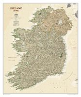
Wandkaart Ierland, antiek, 76 x 92 cm | National Geographic
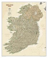
National Geographic Maps' new Ireland wall map is one of the most authoritative maps yet published of the Emerald Isle. Of the nearly 1,000 place-names shown on this map, all within the Republic of Ireland adhere to that nation's constitution—that the Irish and English language share official status. Thus, Gaelic (Irish) place-names, along with their English variants in parentheses, are shown within Irish-speaking regions while English place-names, along with their Gaelic variants, are shown outside these areas.   Ireland Classic is ideal for those researching their Irish ancestry, a perfect tool for business reference, and a beautiful addition to any décor. It’s one of the largest and most detailed wall maps specifically for Ireland available today. Shown on the map are over 1,000 named places including primary and secondary towns, counties, political boundaries, infrastructure, and selected historical sites for both Ireland and Northern Ireland.   Place-name Details: Per the Republic…
25,95
Wandkaart Ierland, antiek, 76 x 92 cm | National Geographic
National Geographic Maps' new Ireland wall map is one of the most authoritative maps yet published of the Emerald Isle. Of the nearly 1,000 place-names shown on this map, all within the Republic of Ireland adhere to that nation's constitution—that the Irish and English language share official status. Thus, Gaelic (Irish) place-names, along with their English variants in parentheses, are shown within Irish-speaking regions while English place-names, along with their Gaelic variants, are shown outside these areas.   Ireland Classic is ideal for those researching their Irish ancestry, a perfect tool for business reference, and a beautiful addition to any décor. It’s one of the largest and most detailed wall maps specifically for Ireland available today. Shown on the map are over 1,000 named places including primary and secondary towns, counties, political boundaries, infrastructure, and selected historical sites for both Ireland and Northern Ireland.   Place-name Details: Per the Republic…
31,95
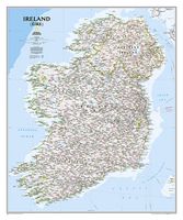
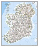
Wandkaart Ireland - Ierland, 76 x 91 cm | National Geographic
National Geographic Maps' new Ireland wall map is one of the most authoritative maps yet published of the Emerald Isle. Of the nearly 1,000 place-names shown on this map, all within the Republic of Ireland adhere to that nation's constitution—that the Irish and English language share official status. Thus, Gaelic (Irish) place-names, along with their English variants in parentheses, are shown within Irish-speaking regions while English place-names, along with their Gaelic variants, are shown outside these areas.   Ireland Classic is ideal for those researching their Irish ancestry, a perfect tool for business reference, and a beautiful addition to any décor. It’s one of the largest and most detailed wall maps specifically for Ireland available today. Shown on the map are over 1,000 named places including primary and secondary towns, counties, political boundaries, infrastructure, and selected historical sites for both Ireland and Northern Ireland.   Place-name Details: Per the Republic…
25,95
Wandkaart Ireland - Ierland, 76 x 91 cm | National Geographic
National Geographic Maps' new Ireland wall map is one of the most authoritative maps yet published of the Emerald Isle. Of the nearly 1,000 place-names shown on this map, all within the Republic of Ireland adhere to that nation's constitution—that the Irish and English language share official status. Thus, Gaelic (Irish) place-names, along with their English variants in parentheses, are shown within Irish-speaking regions while English place-names, along with their Gaelic variants, are shown outside these areas.   Ireland Classic is ideal for those researching their Irish ancestry, a perfect tool for business reference, and a beautiful addition to any décor. It’s one of the largest and most detailed wall maps specifically for Ireland available today. Shown on the map are over 1,000 named places including primary and secondary towns, counties, political boundaries, infrastructure, and selected historical sites for both Ireland and Northern Ireland.   Place-name Details: Per the Republic…
31,95
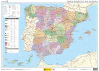
Wandkaart Spanje, 70 x 50 cm | CNIG - Instituto Geográfico Nacional
Administrative provinces of Spain shown in bright colours on a wall map at 1:2,250,000, size 70 x 50cm (27.5" x 20" approx), from IGN/CNIG - the country’s civilian survey organization, plus a panel of regional flags. Each province is presented in a different colour and the map also shows boundaries and names of administrative regions. Town symbols and names indicate their size and administrative status. The map shows the network of main roads and railways. Latitude and longitude lines are drawn at intervals of 1°. Map legend is in Spanish only.    Next to the map is a panel listing Spain’s autonomous regions, including Ceuta and Melilla, each with its flag, plus a list of its constituent provinces and their capitals. Mapa General de España (Península Ibérica, Baleares, Canarias, Ceuta, Melilla y posesiones españolas en el norte de África) a escala 1:2.000.000, con división autonómica. Proyección Lambert.
16,95
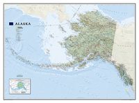
Wandkaart Alaska, 103 x 78 cm | National Geographic
Deze wandkaart van National Geographic is zeer gedetailleerd en bevat alle belangrijke plaatsen. Daarnaast is er ruimte voor de landschappelijke details zoals hoogtelijnen, rivieren, belangrijke wegen en andere items zoals politieke grenzen, luchthavens .    Alaska physical wall map, size 103 x 78cm at 1:3,660,000 from the National Geographic, with colouring to show the topography and plenty of place names. Coverage includes the panhandle and the outermost Aleutian Islands in their proper geographical placing.   Altitude colouring and relief shading shows the topography, with names of mountain ranges, peaks with heights (in feet), etc. Boundaries of national parks and other protected areas are marked. The map shows Alaska’s road network, the railway line from Anchorage to Fairbanks, numerous local airfields with scheduled air or seaplane services, and ferry routes. The map has a very large number of place names: towns and settlements, geographical features including islands, bays, etc.…
36,95
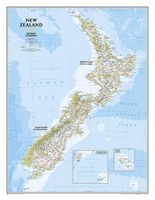
Wandkaart New Zealand - Nieuw Zeeland 60 x 77 cm | National Geographic
Mooie heldere wandkaart van Nieuw Zeeland met het Noordereiland en Zuidereiland op dezelfde kant afgebeeld. Veel plaatsnamen, goed kleurgebruik waardoor hoogteverschillen en bijvoorbeeld nationale parken goed zichtbaar zijn.   The reference map of New Zealand uses National Geographic's signature Classic style with blue ocean and stunning shaded relief. The map shows this island nation in great detail, from the subtropical North Island (Te Ika-a-Maui) to the glacial carved valleys of Fiordland on the South Island (Te Waipounamu). The North Island is best known for large volcanic lakes and the cities of Auckland and Wellington. The South Island is famous for the Southern Alps that run along the spine of the island. The highest point in the country is Aoraki (Mount Cook) and is found in the Southern Alps.   The first settlers of New Zealand were the Maori from Polynesia, the names on the map reflect this history with both English and Maori variants. The map also features a transportation …
31,95

Klanten-reviews van Wandkaart Frankrijk, België en Nederland, 60 x 77 cm | National Geographic

Er zijn nog geen beoordelingen voor dit productBen jij de eerste die een review plaatst?

Meer over Wandkaart Frankrijk, België en Nederland, 60 x 77 cm | National Geographic

Productomschrijving

>Our classic wall map of France, Belgium, and the Netherlands shows political boundaries, major highways and roads, cities and towns, and a wealth of other incredibly accurate geographic detail.    France the map shows the division of the country into regions, with a list of their names and regional capitals (curiously, Corsica is not included on the map – what would Napoleon think of that?). The map also provides plenty of names of both geographical features (Pyrenees, Cevennes, etc) and the country’s traditional historical regions (Gascony, Maine, Bourbonais, etc). National parks are highlighted. Within Belgium the map indicates the division into Flanders, Wallonia and the Brussels Region and in the Netherlands boundaries of the country’s administrative provinces are marked. Topography is shown by relief shading and within the Netherlands the areas below the sea level are also indicated. The map shows the network of main road and rail connections, local airports, as well as ferry links.
Webshop.nl maakt gebruik van cookies. Ga je verder op onze website, ga dan akkoord met het plaatsen van cookies en de verwerking van deze data door ons en vermelde partners.