webshop.nl
Categorieën
  Sluiten

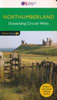
Wandelgids Northumberland | Ordnance Survey

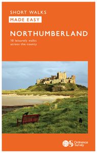
Explore the castles and coast of Northumberland from Dunstanburgh to Hadrian’s Wall with ten walks suitable for all ages and abilities. Discover England’s most northerly county from the North Sea coast to the North Pennines on hand-picked, leisurely rambles for the whole family.   Northumberland Short Walks Made Easy include:   - Circle dramatic Ba...
10,95

Webshops met dit product

Webshop
Bezorging
Prijs

Anderen bekeken ook

Wandelgids 87 Pathfinder Guides Northumberland | Ordnance Survey
Pathfinder® Guide to Northumberland, featuring 28 outstanding walks designed for a range of abilities covering 180 miles of walking.   Features:   28 guided walks for a range of abilities Large detailed Ordnance Survey map extracts Key information such as parking and type of terrain GPS waypoints for each route Weather-resistant book cover Durable rounded corners   This new guide to Northumberland has ten brand-new Pathfinder walks across the county. There are new short walks at Berwick-upon-Tweed, Almouth and Bellingham. There are new half-day walks in the Coquet Valley at Felton, in the Humbleton Hills from Wooler, exploring the countryside south of the River Tyne from Hexham, and taking you along the scenic Wansbeck Valley to Morpeth from Bothal. And there are new longer walks in Hulne Park, Alnwick; along the coast and inland from Bamburgh; and a lengthy but hugely enjoyable ramble in a circuit from Druridge Bay to Warkworth and a return via Amble along the Northumberlan…
18,50
Wandelgids Aviemore and the Cairngorms | Ordnance Survey
Get outside in the Cairngorms, Britain’s largest national park, with ten tried-and-tested accessible walks along the Spey Valley. Discover ancient Caledonian woodland, beautiful lochs and sparkling rivers against a backdrop of snow-capped mountains, waiting for the whole family to enjoy.   Aviemore and the Cairngorms Short Walks Made Easy include:   - Explore Loch Garten and Loch Mallachie, an RSPB Reserve and a haven for ospreys, and pine woodland filled with rare wildlife - Follow the line of the Strathspey Railway and see steam trains chugging past from Aviemore to the ‘osprey village’ of Boat of Garten - Go for a woodland ramble through Glenmore Forest Park to glacial Loch Morlich, where you can stroll the red sands of the highest beach in Britain - Wander the enchanted shores of Loch an Eileen, where a ruined castle stands on the loch’s one island - Stroll through wildflower-rich meadows on the banks of the Calder and the Spey as you circle Newtonmore - See the iconic Old Packhors…
9,95
Wandelgids Walking in Northumberland | Cicerone
De wandelgidsen van Cicerone zijn toonaangevend als het gaat om kwaliteit en de hoeveelheid verschillende bestemmingen. De routes zijn helder en duidelijk beschreven, kaartmateriaal is veelal van de topografische dienst op schaal 1:50.000 en de praktische informatie is bondig maar zeer relevant.    The book comprises 36 short walking routes between 4 and 14 miles in Northumberland, England's most sparsely populated county. Ranging from easy ambles and gentle woodland trails to long days on the hills: there is something for all types of walker - and all types of weather. Taking in the beautiful coast with its immense, empty beaches and dramatic crag-top castles to the remote hills of the Cheviots and Pennines, the whole county is covered. Most of the routes are circular, but there are a few linear walks that make use of local bus services.    The landscapes are rich in history, featuring Hadrian's Wall, Lindisfarne Priory, Bamburgh and Dunstanburgh castles, and much more.    The walks a…
18,50
Wandelgids 79 Pathfinder Guides Dee Valley, Clwydian Hills and North East Wales | Ordnance Survey
Fraaie, goed verzorgde wandelgidsjes met 28 wandelingen van max. een dag, (beginnend bij korte, eindigend bij langere wandelingen). Weergegeven op duidelijke topografische kaartjes (1:25.000). Bevat verder wetenswaardigheden en praktische informatie voor onderweg. Enjoy 145 miles of lush green walks in north-east Wales with 28 superb country walks, graded by length and difficulty. Choose from 14 routes in the Cylwdian Range and Dee Valley Area of Outstanding Natural Beauty, three on the North Wales coast between Great Orme and Point of Ayr and 11 in Denbighshire and Flintshire to the east of the River Conwy – or do them all!   Featured Dee Valley, Clwydian Hills and North-East Wales walks include:   - Follow the Wales Coast Path along the coastal sand dunes to Point of Ayr and Prestatyn - Circle Great Orme for impressive views of Llandudno, the coast and the mountains of Snowdonia - Stroll along the Llandudno Canal to the magnificent Pontcysyllte Aqueduct, a World Heritage Site - Rambl…
18,50
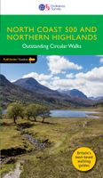
Wandelgids 83 Pathfinder Guides North Coast 500 and Northern Highlands | Ordnance Survey
Enhance your North Coast 500 tour with the only walking guidebook featuring routes based on or accessible from Scotland’s ultimate road trip. Discover Britain’s remotest sandy beaches, Scotland’s most northerly munro, some of the oldest rocks on Earth and more with 28 breathtaking walks accessed from the North Coast 500 as well as 32 unmissable stop-off-and-stroll recommendations.   Featured North Coast 500 and Northern Highlands walks include:   - Circle Loch Coulin where Beinn Eighe and Liathach are reflected in the still waters - Wander the astounding landscape of Knockan Crag, where some of the oldest rocks on Earth can be seen - Climb Ben Hope, Scotland’s most northerly munro, towering above the Flow Country - See the waterfalls and rocks walls of the Big Burn as you ascend Ben Bhraggie for views over the Dornoch Firth - Explore the landscape and history of the Applecross peninsula with sublime views of Raasay - Take a moorland and clifftop route to the vast golden sands of Sandwo…
18,50
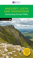
Wandelgids 78 Pathfinder Guides Anglesey, Lleyn and Snowdonia | Ordnance Survey
Fraaie, goed verzorgde wandelgidsjes met 28 wandelingen van max. een dag, (beginnend bij korte, eindigend bij langere wandelingen). Weergegeven op duidelijke topografische kaartjes (1:25.000). Bevat verder wetenswaardigheden en praktische informatie voor onderweg. Experience breathtaking north Wales with 28 unforgettable walks through Anglesey, the Lleyn Peninsula and the Snowdonia National Park. Find stunning views of the Welsh coast, the ‘holy isle’ of Ynys Mon and sublime Snowdonia with a range of walks graded by length and difficulty, from relaxed rambles to challenging climbs.   Featured Anglesey, Lleyn and Snowdonia walks include:   - Enjoy views of Snowdon from the shores of Llyn Padarn, dotted with remnants of the Llanberis slate quarries and a medieval castle - Climb to Holyhead Mountain, Anglesey’s highest point, through the South Stacks Cliff Nature Reserve - See the glorious Lleyn Heritage Coast from the headland of Trywn-y-Tâl, circling back to the pleasant village of Tref…
18,50
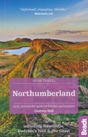
Reisgids Slow Travel Northumberland | Bradt Travel Guides
Een bijzondere serie van Bradt guides, waarin een gedeelte van Engeland of Schotland uitgebreid beschreven wordt. Met veel aandacht voor kleine details die je niet al gauw elders zult vinden. Naast de beschrijvende informatie vind je ook een schat aan praktische informatie als accommodatie-adressen of leuke pubs. Een aanrader! This new, thoroughly updated second edition of Bradt's best-selling, comprehensive guide to Northumberland including Newcastle, Hadrian's Wall & the Coast remains the reliable source of information for discovering the far northeast of England, an area which is home to Europe's largest area of protected night sky - and England's first Dark Sky Park, a 572-square-mile expanse in Northumberland National Park.   Now including over 40 walks along beaches, over hills and through valleys, as well as dedicated chapters on Northumberland National Park, Hadrian's Wall, the coast and Newcastle, among others, Bradt's Northumberland including Newcastle, Hadrian's Wall & the C…
18,50
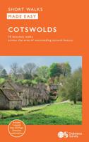
Wandelgids Cotswolds | Ordnance Survey
Explore ten easy-paced, family-friendly short walks across the Cotswolds Area of Outstanding Natural Beauty. Originating from a Saxon term meaning ‘wooded hollows, amid gentle hills’, the AONB straddles six counties, and is best known for its honey-coloured stone cottages, lush rolling hills, and deeply-cut wooded valleys. Walks explore quieter corners of the region, covering fine gardens, rivers, parkland, and charming villages.       What to expect from Cotswolds Short Walks Made Easy:   • For quintessential Cotswold views, follow the trail from Broadway, escaping the crowds up a gently sloping hill to a sleepy hamlet and tempting tearooms   • Take a stroll down the magnificent Broad Ride in Cirencester Park, briefly enjoying the beautiful Roman town of Cirencester   • Have your camera ready to snap the country’s most photographed cottages at Arlington Row, whilst on an outing from Bibury   • Admiring formal gardens at the stately homes of Sudeley Castle and Blenheim Palace, you can …
13,50
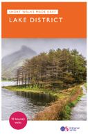
Wandelgids Lake District National Park | Ordnance Survey
Explore the spectacular scenery of the Lake District without scaling the high fells on these accessible walks that everybody can enjoy, covering the whole of the National Park. Wander the tranquil shores of Lakeland and drink in dazzling views on a day out for the whole family.   Lake District Short Walks Made Easy include:   - Make a leisurely circuit of beautiful Buttermere and the woodlands and meadows surrounding it, with a backdrop of rugged high fells - Follow a stretch of the Ullswater Way beside one of Lakeland’s most spectacular bodies of water (with optional detour to stunning Aira Force waterfall) – and catch one of the iconic ‘Steamers’ back - Walk in William Wordsworth’s footsteps from Grasmere village through oak woodlands and around the shores of Grasmere, visiting the poet’s grave en route - Start at imposing Wray Castle, glimpse Belham Tarn and enjoy stunning views of Windermere, England’s largest natural lake - Stroll along a stretch of the England Coast Path to the p…
10,95
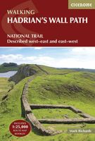
Wandelgids Hadrian's Wall Path | Cicerone
Meest duidelijke wandelgids van de route: veel details in kaarten en informatie, beide kanten op beschreven! The essential guidebook to walking the 84-mile Hadrian’s Wall Path. One of the UK's most visited National Trails, it runs the length of the Roman Wall from Bowness-on-Solway in Cumbria to Wallsend, Newcastle.   Begun in AD122 and stretching from the River Tyne to the Solway Firth, Hadrian’s Wall was a massive feat of engineering and is the best preserved frontier from the classical Roman Empire. Today it is a World Heritage Site, with iconic scenery and fascinating archaeological remains like Birdoswald, Housesteads and Vindolanda, giving a glimpse into Roman life and power. The trail is presented here in 10 stages, with suggestions for five and eight-day itineraries. It is suitable for beginners, although a reasonable level of fitness is required if doing it as a multi-day trek. The route is described both west to east and east to west, and the guidebook also features extension…
24,95

Klanten-reviews van Wandelgids Northumberland | Ordnance Survey

Er zijn nog geen beoordelingen voor dit productBen jij de eerste die een review plaatst?

Meer over Wandelgids Northumberland | Ordnance Survey

Productomschrijving

Explore the castles and coast of Northumberland from Dunstanburgh to Hadrian’s Wall with ten walks suitable for all ages and abilities. Discover England’s most northerly county from the North Sea coast to the North Pennines on hand-picked, leisurely rambles for the whole family.   Northumberland Short Walks Made Easy include:   - Circle dramatic Bamburgh Castle, looking out to the Farne Islands from wildlife-rich dunes, and see the grave of lifeboat heroine Grace Darling - Enjoy the tranquility of secluded Wooler Common with its wealth of wildlife and ancient remains on the edge of the Cheviots - Start at picturesque Craster and follow the coast path to Dunstanburgh Castle, a rugged ruin perched on a rocky, wave-battered headland - Ramble the shores of Kielder Water, spot nesting ospreys and stumble upon the fascinating artworks in the forest - Follow Hadrian’s Wall from Cawfields near Haltwhistle to see the iconic Roman structure close up, with stunning views in both directions - Stroll along the banks of the River Tyne and see Hexham’s medieval abbey - Climb Shaftoe Crags for far-reaching views of central Northumberland   OS Pathfinder Guides: Short Walks Made Easy:   - 10 accessible walks suitable for the whole family - All routes are between 2 to 5 miles and can be completed all year round - Know what to expect before you go: Information on locations of cafes/pubs and toilets, terrain, hilliness and accessibility for pushchairs and wheelchairs - Large-scale Ordnance Survey maps for ultra-easy navigation and route-finding, featuring intuitive pictorial symbols - Numbered points which tie maps to route descriptions and walk profiles - Route photographs for each numbered point so you know exactly where you’re going - Discover GPS waypoints, parking information and detailed route descriptions for foolproof navigation - Enhance your adventure with stories behind each walk and nature notes - Get active outside and enjoy the physical and mental health benefits  
Webshop.nl maakt gebruik van cookies. Ga je verder op onze website, ga dan akkoord met het plaatsen van cookies en de verwerking van deze data door ons en vermelde partners.