webshop.nl
Categorieën
  Sluiten

Stadsplattegrond Pocket map Pretoria | MapStudio

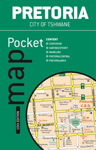
The Pretoria Pocket Map is a new edition convenient pocket size map of Pretoria which includes the latest up-to-date information, key tourist areas and street plans. The map includes a detailed map at 1:12 500 scale plus a map of the Hartebeespoort area with a scale of 1:100 000.   The detailed street plan includes: – Main & minor roads – Retail ar...
11,50

Webshops met dit product

Webshop
Bezorging
Prijs

Anderen bekeken ook

Wegenkaart - landkaart - Stadsplattegrond Bloemfontein | MapStudio
Uitgebreide stadsplattegrond van Bloemfontein  en directe omgeving. The Bloemfontein Street Map is a 1st edition street map providing coverage of Bloemfontein and surrounds, plus includes the latest interchange layouts, names and route numbers. The main map is at a 1:25 000 street-level scale and includes a detailed Bloemfontein map.   The map features reserves, parks and fields; golf courses, sports fields and stadiums; retail areas and shopping malls; intersection layouts, route numbers and interchange names; places of interest, historic sites and hotels; suburb names with boundaries; schools and sporting venue locations; a detailed index booklet with all street names and suburbs; industrial areas; hospitals and clinic locations; police station locations; wine estates and heritage sites; traffic light positions; bird sanctuaries; detailed sport symbols for sport venues; parks and public open-areas; post office and library locations.   Coverage Extent: Batho, Brandwag, Fichardt Park, …
7,95
Wegenatlas Glovebox South Africa - Zuid-Afrika | A5-Formaat | Ringband | MapStudio
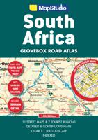
Handzame pocket atlas, A5 formaat, voor Zuid Afrika. Schaal 1 op 1.500.000 en in handige ringband.   This wiro bound Road Atlas South Africa Glovebox is a revised and updated compact atlas.   It includes: Detailed and continuous map section Highlights seven major tourist areas Features eleven street maps Freeways National roads Route numbers Nature reserves and parks Places of interest Tourist information Index to place names and GPS co-ordinates   This edition also features GPS co-ordinates at main interchanges.   COVERAGE: Includes a detailed map of South Africa at a scale of 1 : 1 500 000. The 7 major tourist areas of the Cape Peninsula, South Western Cape and Overberg Region, Garden Route, Gauteng, Kruger National Park, Drakensberg and Kwazulu-Natal coast. The 11 street maps are of Pietermaritzburg, Durban, Nelspruit, Polokwane, Pretoria, Johannesburg, Bloemfontein, Kimberley, East London, Port Elizabeth and Cape Town.  
18,95
Stadsplattegrond Pocket Map Dublin | Collins
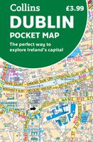
Explore new places with handy pocket maps from Collins. Handy little full colour Collins map of central Dublin with a high level of detail. Map at a scale of 1:7,800 (8 inches to 1 mile).   Includes major tourist landmarks. Clear, detailed, full colour Collins mapping is presented in a handy format ideal for the pocket or handbag. It is excellent value and covers the most visited areas of central Dublin.   It is an essential buy for tourists and residents alike. This map includes:* Detailed central area map* Tourist locations* Tram, train, bus stations and ferry information* Listing of major places to visit, with additional details for the main attractions* Detailed street index* Around Dublin area map extending to airport, Dun Laoghaire and Maynooth  
7,95
Stadsplattegrond Streetmap Cape Town - Kaapstad | MapStudio
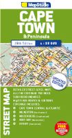
Uitgebreide stadsplattegrond van Kaapstad en directe omgeving.    The Cape Town & Peninsula Street Map is the ideal travel companion to find your way around Cape Town.   Coverage includes:   North : Milnerton West : Hout Bay East : Jakes Gerwel (Vanguard Drive) South : Muizenberg   Great content which includes a detailed map of Cape Town CBD and Waterfront insert map.   The main map is in detailed 1: 25 000 street level scale, which depicts parks and reserves, golf courses, sports fields and stadiums, intersections, route numbers and interchange names. The map also includes places of interest, historical sites and hotels, suburb names and boundaries, schools and sporting venues, industrial areas, wine estates and heritage sites as well as bird sanctuaries and post offices and libaries.  
16,95
Stadsplattegrond Pocket Street Map Bath | A-Z Map Company
This up-to-date detailed A-Z street map includes more than 1,700 streets in and around Bath. This street map includes the following: Postcode districts, one-way streets and car parks Tourist attractions and places of interest marked On the reverse side of the map there is a handy index to streets, places of interest, place and area names, park and ride sites, national rail stations, hospitals and hospicesIdeal companion to a sat-nav - it enables route planning and route sense-checking Extensive mapping covers an area from Charlcombe in the north to Combe Down in the south, and from Bathampton Down in the east to Whiteway in the west. With clear mapping at a scale of 5.5 inches to 1 mile, this is the perfect reference map for finding your way around Bath.
7,95
Stadsplattegrond Pocket Street Map Cambridge | A-Z Map Company
Stadsplattegrond van Cambridge in 48 pagina´s, inclusief index met straatnamen en belangrijke plaatsen. Bevat tevens een detail weergave van het centrum.   Navigate your way around Cambridge with detailed street maps from A-Z This up-to-date, folded A-Z street map includes more than 2,000 streets in and around Norwich. As well as the Norwich Cathedral and central Norwich, the other areas covered include Cringleford, Lakenham, Whitlingham Country Park, Thorpe St Andrew, New Catton and Hellesdon. The large scale 1 mile to 5.5 inch (1 km to 8.68 cm) street map includes the following: • Places of interest • One-way streets and car parks • Index to streets, places of interest, place and area names, park and ride sites, national rail stations, hospitals and hospices The perfect reference map for finding your way around Norwich.  
7,95
Stadsplattegrond Pocket Street Map Birmingham | A-Z Map Company
Handzame stadsplattegrond van het centrum van Birmingham. This up-to-date detailed A-Z street map includes more than 3,000 streets in and around Birmingham. As well as the city centre and St Philip’s Cathedral, the other areas covered include Moseley, Edgbaston, Small Heath, the Jewellery Quarter, Winson Green, Gib heath, Lozells, Saltley and Aston.   The large-scale street map includes the following: • Places of interest • Postcode districts, one-way streets and car parks • Index to streets, places of interest, place and area names, park and ride sites, national rail stations, hospitals and hospices   The perfect reference map for finding your way around Birmingham.
7,95
Stadsplattegrond Pocket Street Map Manchester | A-Z Map Company
Handzame stadsplattegrond van het centrum van Manchester This up-to-date detailed A-Z street map includes more than 2,000 streets in and around Manchester. As well as the Northern Quarter and Spinningfields, the other areas covered include Moss Side, Ordsall, Weaste, Salford, Seedley, Lower Kersal, Strangeways, Miles Platting and West Gorton.The large-scale street map includes the following: - Places of interest- Postcode districts, one-way streets and car parks- Index to streets, places of interest, place and area names, park and ride sites, national rail stations, hospitals and hospices. The perfect reference map for finding your way around Manchester.
7,95
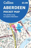
Stadsplattegrond Pocket Map Aberdeen | Collins
Handy little full colour Collins map of Aberdeen with a high level of detail. Clear mapping of the central area extending to the airport and along the coast, with all tourist locations. Map at a scale of 1:10 725 (5.8 inches to 1 mile).   Clear, detailed, full colour Collins mapping is presented in a handy format ideal for the pocket or handbag. It is excellent value and covers the most visited area of central Aberdeen. It is an essential buy for tourists and residents alike.   This map includes: • Detailed central area map • Around Aberdeen map extending to airport and along the coast • Tourist locations • Train and bus stations • Listing of major places to visit, with additional details for Aberdeen Maritime Museum and Duthie Park Winter Gardens • Detailed street index
7,95
Wegenkaart - landkaart Pocket map South Africa Zuid Afrika | MapStudio
Handige kleine kaart van Zuid Afrika. South Africa Pocket Map is a  handy pocket map which is an ideal guide to South Africa for any tourist. The map includes detailed area maps of Kruger National Park, the Garden Route, Cape Winelands, Drakensberg, Magaliesberg & the Kwazulu-Natal coast.   South Africa Pocket Map display places of interest, wine estates, national parks & nature reserves, historical sites, accommodation, toll routes, route numbers and a distance table. Also included are border crossings, camps and tented camps.   This is a great map to have on a game drive or tour of South Africa!   Content includes the following as well: – Legend – Index to place names – Freeways – Interchanges – Route numbers – Nature reserves & parks – Tourist information  
13,95

Klanten-reviews van Stadsplattegrond Pocket map Pretoria | MapStudio

Er zijn nog geen beoordelingen voor dit productBen jij de eerste die een review plaatst?

Meer over Stadsplattegrond Pocket map Pretoria | MapStudio

Productomschrijving

The Pretoria Pocket Map is a new edition convenient pocket size map of Pretoria which includes the latest up-to-date information, key tourist areas and street plans. The map includes a detailed map at 1:12 500 scale plus a map of the Hartebeespoort area with a scale of 1:100 000.   The detailed street plan includes: – Main & minor roads – Retail areas – Traffic light positions – Hotels & accommodation – Tourist information – Places of interest & historic sites – Theatres & cinemas – Shopping malls – Parking – One-way streets – Sports and recreation areas – Embassy positions – Index of street names   The detailed area map covers: – Akasia – Hartebeespoort – Atteridgeville – Pretoria CBD – Mamelodi – Renosterspruit – Centurion, Moreleta Park, Rietvlei & Midrand Estates – Built-up areas with suburb names – Index of street names & suburbs
Webshop.nl maakt gebruik van cookies. Ga je verder op onze website, ga dan akkoord met het plaatsen van cookies en de verwerking van deze data door ons en vermelde partners.