webshop.nl
Categorieën
  Sluiten

Stadsplattegrond Los Angeles | Borch

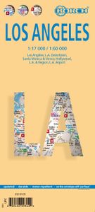
Borch Los Angeles is een duidelijke, geplastificeerde plattegrond van het centrum met informatie over openbaar vervoer en bezienswaardigheden. Inclusief straatnamenregister.   Our soft-laminated folded map of Los Angeles shows: Los Angeles 1:60 000, L.A. Downtown 1:17 000, Santa Monica & Venice 1:20 000, Hollywood 1:15 000, L.A. & Region 1:225 000,...
11,50

Webshops met dit product

Webshop
Bezorging
Prijs

Anderen bekeken ook

Stadsplattegrond Singapore | Borch
Borch Singapore is een duidelijke, geplastificeerde plattegrond van het centrum met informatie over openbaar vervoer en bezienswaardigheden. Inclusief straatnamenregister. Our soft-laminated folded map of Singapore shows: Singapore City 1:14 000, Singapore 1:120 000, Sentosa Island 1:25 000, Changi Airport 1:4 000 and the Public Transportation SMRT schematic map. Borch Maps are easy to fold, durable and water-repellent with a wipeable surface. Borch Maps show hotels, museums, monuments, markets, public transport, top sights and points of interest, useful statistics, conversion charts for temperatures, weights and measurements, climate charts showing temperatures, sunshine hours, precipitation and sea temperatures, overview maps and much more...   The Republic of Singapore (also known as "Lion City", although history tells us Singapore's founder probably meant "tigers") is a very clean and orderly city-state located on the southern tip of the Malay Peninsula, with Changi airport usually…
10,25
Stadsplattegrond Philadelphia | Borch
Borch Philadelphia is een duidelijke, geplastificeerde plattegrond van het centrum met informatie over openbaar vervoer en bezienswaardigheden. Inclusief straatnamenregister.   Our soft-laminated folded map of Philadelphia shows: Philadelphia Downtown 1:7 000, Philadelphia & Region 1:125 000, University City 1:12 000, Fairmount Park 1:15 000, Public Transport Philadelphia, Top 30 Sights, USA administrative & time zones. Borch Maps are easy to fold, durable and water-repellent with a wipeable surface. Borch Maps show hotels, museums, monuments, markets, public transport, top sights and points of interest, useful statistics, conversion charts for temperatures, weights and measurements, climate charts showing temperatures, sunshine hours, precipitation and humidity, overview maps, time zones, and much more...   Thanks to Benjamin Franklin, one of the founding fathers of the United States, the ideas and actions leading to the American Revolution were formed in Philadelphia and for this rea…
11,50
Stadsplattegrond Istanbul | Borch
Borch Istanbul is een duidelijke, geplastificeerde plattegrond van het centrum met informatie over openbaar vervoer en bezienswaardigheden. Inclusief straatnamenregister.   Our soft-laminated folded map of Istanbul shows: Istanbul 1:11 000, Topkapi Palace 1:4 000, Grand Bazaar 1:3 000, Üsküdar 1:13 000, Greater Istanbul 1:150 000, Northwestern Turkey 1:2 000 000, Public Transport Istanbul, Turkey administrative & time zones, Top 30 sights. Borch Maps are easy to fold, durable and water-repellent with a wipeable surface. Borch Maps show hotels, museums, monuments, markets, public transport, top sights and points of interest, useful statistics, conversion charts for temperatures, weights and measurements, climate charts showing temperatures, sunshine hours, precipitation and humidity, overview maps, time zones, and much more...   Istanbul (formerly known as Byzantium and Constantinople) is Europe's most populous city (circa 13 million inhabitants) and is located on the Bosphorus Strait. …
10,25
Stadsplattegrond Praag | Borch
Borch Praag is een duidelijke, geplastificeerde plattegrond van het centrum met informatie over openbaar vervoer en bezienswaardigheden. Inclusief straatnamenregister. Our soft-laminated folded map of Prague shows: Old Town & Lesser Quarter 1:10 000, Prague 1:15 000, Prague Castle 1:5 000, Prague & Region 1:100 000, Czech Republic (West) 1:1 200 000, Public Transport Prague, Czech Republic administrative. Borch Maps are easy to fold, durable and water-repellent with a wipeable surface. Borch Maps show hotels, museums, monuments, markets, public transport, top sights and points of interest, useful statistics, conversion charts for temperatures, weights and measurements, climate charts showing temperatures, sunshine hours, precipitation and humidity, overview maps, time zones, and much more...   Prague, also known as "the Golden City" or "the City of a Hundred Spires" is the capital and largest city in the Czech Republic. Situated in the center of Bohemia it is set romantically on the ba…
10,25
Stadsplattegrond Toronto | Borch
Borch Toronto is een duidelijke, geplastificeerde plattegrond van het centrum met informatie over openbaar vervoer en bezienswaardigheden. Inclusief straatnamenregister.   Our soft-laminated folded map of Toronto shows: Toronto City 1:17 500, The Beaches 1:17 500, Toronto Islands 1:20 000, Toronto & Region 1:500 000, Niagara Falls 1:25 000, Public Transport Toronto, Canada administrative & time zones and Top 30 Sights. Borch Maps are easy to fold, durable and water-repellent with a wipeable surface. Borch Maps show hotels, museums, monuments, markets, public transport, top sights and points of interest, useful statistics, conversion charts for temperatures, weights and measurements, climate charts showing temperatures, sunshine hours, precipitation and humidity, overview maps, time zones, and much more...   Toronto, Canada’s largest city and commercial capital, is the capital of the province of Ontario. Telecommunication, transportation, aerospace, business services, finance, media, fi…
10,25
Stadsplattegrond Chicago | Borch
Borch Chicago is een duidelijke, geplastificeerde plattegrond van het centrum met informatie over openbaar vervoer en bezienswaardigheden. Inclusief straatnamenregister.   Our soft-laminated folded map of Chicago shows: Chicago Downtown 1:8 000, Lincoln Park 1:16 000, Hyde Park 1:20 000, Chicago & Region 1:250 000, O'Hare Airport 1: 22 500, Public Transportation CTA, Top 30 Sights and USA administrative & time zones. Borch Maps are easy to fold, durable and water-repellent with a wipeable surface. Borch Maps show hotels, museums, monuments, markets, public transport, top sights and points of interest, useful statistics, conversion charts for temperatures, weights and measurements, climate charts showing temperatures, sunshine hours, precipitation and humidity, overview maps, time zones, and much more...   Not only famous for Barack Obama and Al Capone, Chicago is also called "America's second city" or the "Windy City". Chicago is the largest city in the state of Illinois, is located on…
10,25
Stadsplattegrond Orlando | Borch
Borch Orlando is een duidelijke, geplastificeerde plattegrond van het centrum met informatie over openbaar vervoer en bezienswaardigheden. Inclusief straatnamenregister.   Our soft-laminated folded map of Orlando shows: Orlando Downtown 1:11 000, Central Florida 1:1 200 000, Orlando and Region 1:200 000, Walt Disney World 1:25 000, International Drive Area 1:25 000, Top 30 Sights, USA administrative and time zones. Borch Maps are easy to fold, durable and water-repellent with a wipeable surface. Borch Maps show hotels, museums, monuments, markets, public transport, top sights and points of interest, useful statistics, conversion charts for temperatures, weights and measurements, climate charts showing temperatures, sunshine hours, precipitation and humidity, overview maps, time zones, and much more...   Orlando, America’s fantasy capital, has the second largest number of hotel rooms in the country and is home to the Walt Disney World Resort (including the Magic Kingdom, Epcot, Disney's…
10,25
Stadsplattegrond Brussel | Borch
Borch Brussel is een duidelijke, geplastificeerde plattegrond van het centrum met informatie over openbaar vervoer en bezienswaardigheden. Inclusief straatnamenregister.   Our soft-laminated folded map of Brussels shows: Brussels 1:12 000, Brussels Center 1: 10 900, Grand Place, Brussels Region 1:100 000, Public Transport Brussels and Belgium administrative. Borch maps are easy to fold, durable and water-repellent with a wipeable surface. Borch Maps show hotels, museums, monuments, markets, top sights and points of interest, useful statistics, conversion charts for temperatures, weights and measurements, climate charts showing temperatures, sunshine hours, precipitation and humidity, overview maps, time zones, and much more...   Brussels is considered the capital city of the European Union because of the numerous EU institutions headquartered here. Organisations with their main seat in Brussels include the North Atlantic Treaty Organisation (NATO) and the European Organisation for the …
10,25
Stadsplattegrond Beijing - Peking | Borch
Borch Beijing is een duidelijke, geplastificeerde plattegrond van het centrum met informatie over openbaar vervoer en bezienswaardigheden. Inclusief straatnamenregister.   Our soft-laminated folded map of Beijing shows: Beijing 1:75 000, Central Beijing 1:24 000, Beijing and Region 1:1 200 000, Forbidden City 1:6000, Summer Palace 1:6000, Chengde 1:30 000, Fragrant Hills Park 1:13 000, Badaling 1:18 000, Public Transport Beijing, Top 30 sights, Beijing Shi administrative and China administrative and time zones. Borch maps are easy to fold, durable and water-repellent with a wipeable surface. Borch Maps show hotels, museums, monuments, markets, top sights and points of interest, useful statistics, conversion charts for temperatures, weights and measurements, climate charts showing temperatures, sunshine hours, precipitation and humidity, overview maps, time zones, and much more...   Beijing, formerly known as Peking, is the capital and second most populous city of the People's Republic …
10,25
Stadsplattegrond San Francisco | Borch
Borch San Francisco is een duidelijke, geplastificeerde plattegrond van het centrum met informatie over openbaar vervoer en bezienswaardigheden. Inclusief straatnamenregister.   Our soft-laminated folded map of San Francisco shows: San Francisco Downtown 1:13 000, Alcatraz Island 1: 15 000, Golden Gate Park 1:13 000, San Francisco and Region 1:150 000, San Francisco Bay Area 1:400 000, Public Transport San Francisco, Top 30 Sights and USA administrative and time zones. Borch maps are easy to fold, durable and water-repellent with a wipeable surface. Borch Maps show hotels, museums, monuments, markets, top sights and points of interest, useful statistics, conversion charts for temperatures, weights and measurements, climate charts showing temperatures, sunshine hours, precipitation and humidity, overview maps, time zones, and much more...   The 14th most populous city in the U.S. and the 4th most populous in California is best known for its Golden Gate bridge, cable cars, steep hills li…
10,25

Klanten-reviews van Stadsplattegrond Los Angeles | Borch

Er zijn nog geen beoordelingen voor dit productBen jij de eerste die een review plaatst?

Meer over Stadsplattegrond Los Angeles | Borch

Productomschrijving

Borch Los Angeles is een duidelijke, geplastificeerde plattegrond van het centrum met informatie over openbaar vervoer en bezienswaardigheden. Inclusief straatnamenregister.   Our soft-laminated folded map of Los Angeles shows: Los Angeles 1:60 000, L.A. Downtown 1:17 000, Santa Monica & Venice 1:20 000, Hollywood 1:15 000, L.A. & Region 1:225 000, L.A. Airport 1:20 000, Public Transport Los Angeles, USA administrative and time zones, Top 30 Sights. Borch maps are easy to fold, durable and water-repellent with a wipeable surface. Borch Maps show hotels, museums, monuments, markets, public transport, top sights and points of interest, useful statistics, conversion charts for temperatures, weights and measurements, climate charts showing temperatures, sunshine hours, precipitation and humidity, overview maps, time zones, and much more...   Abbreviated L.A., Los Angeles is the most populous city in California and the 2nd largest English-speaking city in the world. It is best known for being the world's leading producer of popular entertainment: recorded music, television and most of all motion pictures. Because of the city's geographic and climatic location, the huge number of cars used as the main means of transport for Angelinos (L.A. residents) and the very busy port complex at Long Beach, the city is prone to intense smog. Important landmarks include the Disney Concert Hall designed by Frank Gehry, Hollywood Boulevard, Chinatown, the Hollywood Bowl and Little Tokyo. Sunset Strip in West Hollywood is a famous hotspot for both evening entertainment and daytime retail therapy. The Los Angeles Dodgers are at home here, as are nationally rated lacrosse, soccer, football, hockey and basketball teams. Come visit and enjoy L.A., all the way!  
Webshop.nl maakt gebruik van cookies. Ga je verder op onze website, ga dan akkoord met het plaatsen van cookies en de verwerking van deze data door ons en vermelde partners.